Tag: GoogleMaps

Big data: US 2010 census racial map

Big data: US 2010 census racial map

NYC racial data
US 2010 census data on race. Each dot is a person and its colour is defined by race.Blue = white, Green = black, Red = asian, Orange = hispanic and Brown = others


The Weldon Cooper Center for Public Service published an interesting data rich map online the other day. They took all the US 2010 census data about race and decided to plot that on a single map. Each American is represented as a dot (yes that are many dots!).

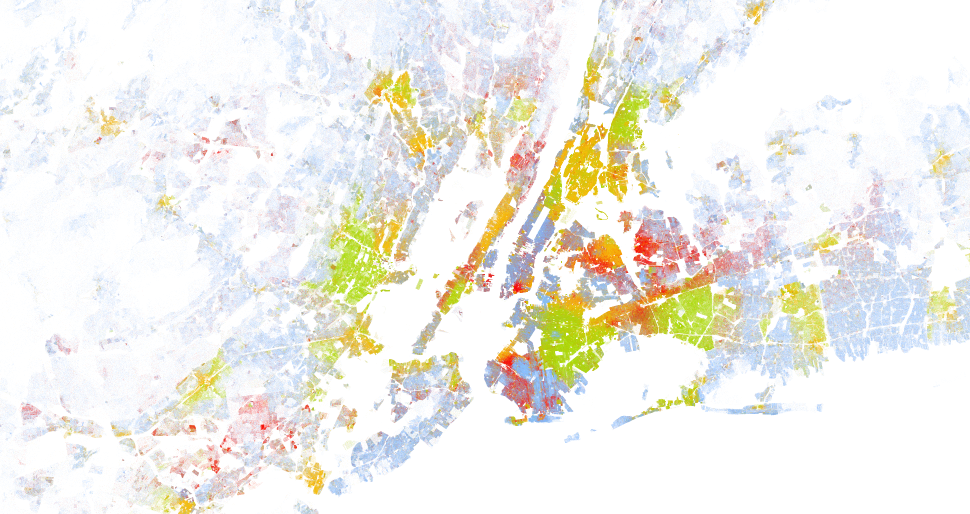
What becomes clear if you go through the map and zoom in/out is how dense populated some areas are and even more how strong the racial boundaries in cities are. You can clearly see on city block level what race is living where and how badly races mingle. See for example the attached screenshot of New York city. You can clearly see the hispanic, the black and the white neighbourhoods on Manhattan island.

Anyway, have a look yourself, be amazed and share screenshot of regions you find interesting:

http://demographics.coopercenter.org/DotMap/index.html

Doesn't understand why I'm not allowed to pre-cache the +Google Maps for…

Doesn't understand why I'm not allowed to pre-cache the +Google Maps for…

Doesn't understand why I'm not allowed to pre-cache the +Google Maps for the Barcelona area. As there is no difference in fetching it on the fly over 3g then pre-fetching it over a fist wifi I think this is an absolute silly restriction and doesn't help usability nor protects whatever Google is trying to protect. The only clear winner in this case are the telecom companies that can charge me ridiculious amounts for roaming…. #rant  

Anyway, not they almost force me to move to Open Street Maps. 

#Google   #GoogleMaps   #usability   #offlinemaps